Medicine Bow-Routt NFs & Thunder Basin NG
Sugarloaf Campground
Campground16 sitesReservable
Photo: USFS
Loading map…
About this campground
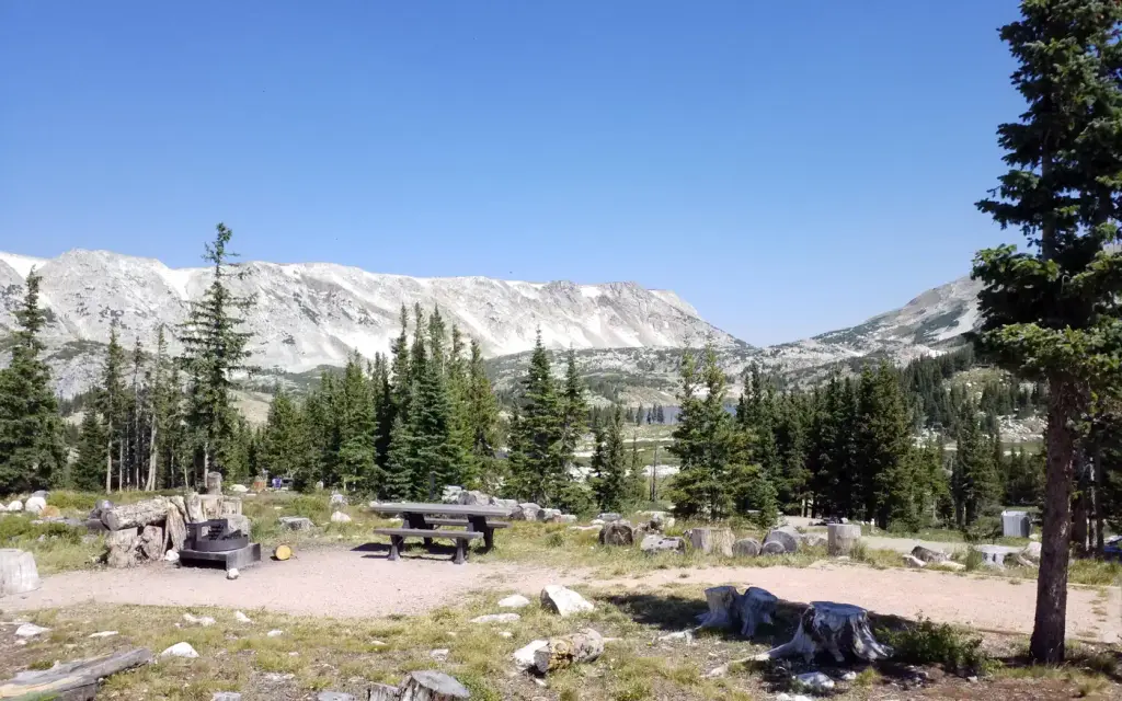
At an elevation of 10,800 feet, Sugarloaf is the highest elevation campground that the Medicine Bow-Routt National Forest has to offer and it is one of the highest elevation campgrounds in the United States. The sites at this location offer a breathtaking panorama of the Snowy Range which peaks out at 12,000 feet.
Sites and hookups
- Campsites
- 16
- Pull-through sites
- 2
- Pets
- Allowed
- Booking
- Reservable on Recreation.gov
Amenities
- Vault toilets
RV parks near Sugarloaf Campground
Nearest first, within 25 miles. Hookups are what each park lists.
More federal campgrounds nearby
- Little Brooklyn Lake Guard2.6 mi · Forest ServiceWaterfront sites
- Brooklyn Lake Campground2.8 mi · Forest Service27 sites · RVs to 45 ft · 5 pull-through · Waterfront sites
- Silver Lake Campground4.5 mi · Forest Service17 sites · 1 pull-through
- Snow Survey Cabin4.8 mi · Forest Service
- North Fork6.4 mi · Forest Service91 sites · RVs to 45 ft
- Ryan Park10.5 mi · Forest Service48 sites · RVs to 70+ ft · 16 pull-through
- South Brush Creek Campground10.9 mi · Forest Service20 sites · 5 pull-through
- Spruce Mtn Fire Lookout Tower11.2 mi · Forest Service
Public recreation nearby
Trailheads, access points and public lands within 25 miles.
- Brush Creek Visitor CenterVisitor center · 12 mi · Forest Service · Medicine Bow-Routt NFs & Thunder Basin NG
- Prospect MountainPublic land · 18.4 mi to center · BLMDetails
Data Source: Recreation.gov


