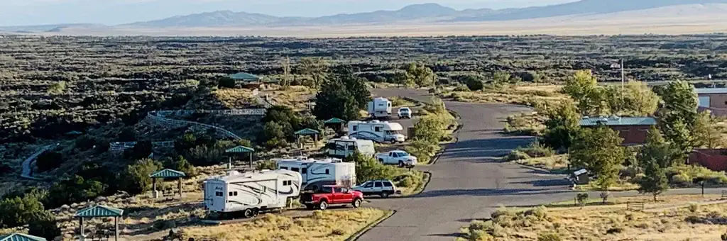
Valley of Fires
Valley of Fires Recreation Area
Campground26 sites50 ampReservable
Photo: BLM
Site map
25 of 26 campsites at their real positions, from the agency's own site coordinates.
- Electric site
- Other site
- Loop, in site-number order
Loading map…
About this campground
Valley of Fires recreation area is located immediately adjacent to the Malpais Lava Flow. Approximately 5,000 years ago, Little Black Peak erupted and flowed 44 miles into the Tularosa Basin, filling the basin with molten rock. The resulting lava flow is four to six miles wide, 160 feet thick and covers 125 square miles.
Sites and hookups
- Campsites
- 26
- Sites by type
- 7 tent, 19 RV
- Electric hookups
- 13 sites, up to 50 amp
- Water hookups
- 15
- Max RV length
- 40 ft
- Pull-through sites
- 10
- Pets
- Allowed
- Campfires
- Allowed
- Booking
- Reservable on Recreation.gov
Amenities
- Showers
- Flush toilets
- Vault toilets
- Drinking water
- Dump station
- Cell service
- Camp host
RV parks near Valley of Fires Recreation Area
Nearest first, within 25 miles. Hookups are what each park lists.
More federal campgrounds nearby
Public recreation nearby
Trailheads, access points and public lands within 25 miles.
- Carrizozo Lava Flow Wilderness Study AreaPublic land · 3.3 mi to center · BLMDetails
- Little Black Peak Wilderness Study AreaPublic land · 5 mi to center · BLMDetails
- Three Rivers Petroglyph SitePublic land · 24.1 mi to center · BLMDetails
- Fort Stanton-Snowy River Cave National Conservation AreaPublic land · 26.7 mi to center · BLMDetails
Data Source: Recreation.gov


