Site map
21 campsites at their real positions, from the agency's own site coordinates.
- Electric site
- Other site
- Loop, in site-number order
Loading map…
About this campground
River Road Campground sits along the shores of Fourche LaFave River and Nimrod Dam, cradled between Arkansas' Ouachita and Ozark Mountains.
Sites and hookups
- Campsites
- 21
- Electric hookups
- 20 sites, up to 50 amp
- Water hookups
- 15
- Max RV length
- 70+ ft
- Pull-through sites
- 3
- Pets
- Allowed
- Campfires
- Allowed
- Booking
- Reservable on Recreation.gov
Amenities
- Playground
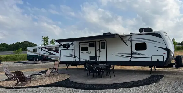
RV parks near River Road
Nearest first, within 25 miles. Hookups are what each park lists.
More federal campgrounds nearby
- Quarry Cove0.8 mi · Army Corps31 sites · 50 amp electric · RVs to 70+ ft · 3 pull-through
- Carter Cove4.9 mi · Army Corps34 sites · 50 amp electric · RVs to 70+ ft · 2 pull-through
- Sunlight Bay8.5 mi · Army Corps29 sites · 50 amp electric · RVs to 70+ ft · 3 pull-through
- Old Post Road20.4 mi · Army Corps41 sites · 50 amp electric · RVs to 70+ ft
- Spring Lake Recreation Area20.6 mi · Forest Service
- Cherokee (Arkansas River)24.2 mi · Army Corps33 sites · 50 amp electric · RVs to 60 ft
- Sorghum Hollow27.9 mi · Forest Service
- Little Fir28.4 mi · Army Corps29 sites · 50 amp electric · RVs to 40 ft
Public recreation nearby
Trailheads, access points and public lands within 25 miles.
- Nimrod LakePublic land · 8.9 mi to center · Army CorpsDetails
- Holla Bend National Wildlife RefugePublic land · 15 mi to center · Fish and Wildlife ServiceDetails
- Ozark-St. Francis National ForestsPublic land · 22.6 mi to center · Forest ServiceDetails
- Dardanelle LakePublic land · 23.4 mi to center · Army CorpsDetails
- Arkansas River - Rockefeller LakePublic land · 24.1 mi to center · Army CorpsDetails
- Little Fir LandingBoat ramp · 33.2 mi · Army Corps · Lake Ouachita
Data Source: Recreation.gov


