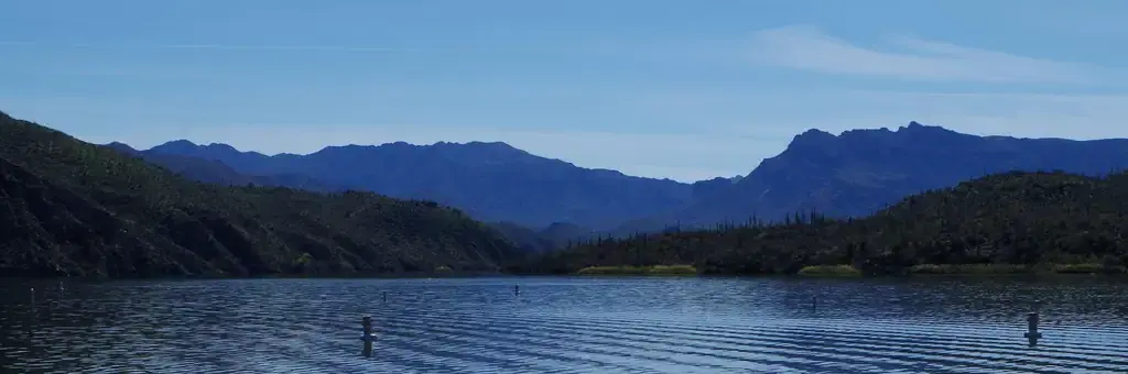
Photo: Tonto NF
Site map
79 campsites at their real positions, from the agency's own site coordinates.
- Campsite
- Loop, in site-number order
Loading map…
About this campground
Burnt Corral Campground and Recreation Area (elevation 1914') is about 5.8 miles south of Roosevelt Dam along the Apache Trail (AZ Hwy 88) along the shoreline of Apache Lake. It is nestled amongst the saguaros, mesquites, and palo verdes, and offers opportunities to boat, swim, fish, relax, hike, and sightsee.
Sites and hookups
- Campsites
- 79
- Max RV length
- 32 ft
- Pull-through sites
- 12
- Waterfront sites
- 79
- Pets
- Allowed
- Campfires
- Allowed
- Booking
- Reservable on Recreation.gov
Amenities
- Vault toilets
- Drinking water
- Boat ramp
- Water access
- Trash pickup
RV parks near Burnt Corral Campground
Nearest first, within 25 miles. Hookups are what each park lists.
More federal campgrounds nearby
- Frazier Horse Campground5 mi · Forest Service8 sites · RVs to 40 ft · 8 pull-through · Waterfront sites
- Frazier Group Campground5.1 mi · Forest Service1 site · RVs to 45 ft · 1 pull-through · Waterfront sites
- Windy Hill Campground7.2 mi · Forest Service137 sites · RVs to 45 ft · 81 pull-through · Waterfront sites
- Cholla Campground7.2 mi · Forest Service167 sites · RVs to 55 ft · 13 pull-through · Waterfront sites
- Grapevine Group Campground9.1 mi · Forest Service9 sites
- Schoolhouse Campground11.1 mi · Forest Service40 sites · RVs to 50 ft · 31 pull-through · Waterfront sites
- Tortilla Campground13.1 mi · Forest Service76 sites · RVs to 32 ft
- Reynolds Creek Group Campground21.3 mi · Forest Service1 site · RVs to 21 ft · 1 pull-through · Waterfront sites
Public recreation nearby
Trailheads, access points and public lands within 25 miles.
Data Source: Recreation.gov


