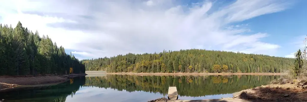
Photo: Joel Miller USFS November 2018.
Site map
30 of 40 campsites at their real positions, from the agency's own site coordinates.
- Campsite
- Loop, in site-number order
Loading map…
About this campground
Shirttail Campground is located on the north shore of Sugar Pine Reservoir, in the Tahoe National Forest, 15 miles from Foresthill. Visitors enjoy the area for its fishing, boating, OHV, and hiking opportunities. This facility is operated and maintained by the Tahoe National Forest.
Sites and hookups
- Campsites
- 40
- Sites by type
- 2 tent
- Max RV length
- 70+ ft
- Pull-through sites
- 2
- Pets
- Allowed
- Booking
- Reservable on Recreation.gov
Amenities
- Vault toilets
- Drinking water
- Firewood
More federal campgrounds nearby
- Giant Gap0.4 mi · Forest Service30 sites · RVs to 60 ft · 7 pull-through
- Forbes Creek0.8 mi · Forest Service2 sites · RVs to 45 ft
- Big Reservoir Campground1.7 mi · Forest Service · First come
- Tunnel Mills II10.5 mi · Forest Service2 sites · RVs to 30 ft · Waterfront sites
- North Fork11.3 mi · Forest Service16 sites · RVs to 50 ft · Waterfront sites
- Skillman12.2 mi · Forest Service16 sites · RVs to 35 ft
- White Cloud12.7 mi · Forest Service45 sites · RVs to 40 ft
- Dru Barner Campground13.8 mi · Forest Service · First come
Public recreation nearby
Trailheads, access points and public lands within 25 miles.
- Sugar Pine ReservoirPublic land · 1.2 mi to center · ReclamationDetails
- North Fork American RiverPublic land · 2.2 mi to center · BLMDetails
- South Yuba Recreation AreaPublic land · 16.8 mi to center · BLMDetails
- Tahoe National ForestPublic land · 22.8 mi to center · Forest ServiceDetails
- American River North Middle South ForksPublic land · 24.4 mi to center · BLM
Data Source: Recreation.gov


