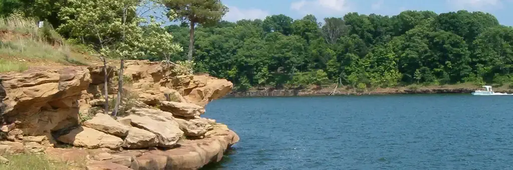
Photo: Mark Wilmes, USACE
Site map
61 campsites at their real positions, from the agency's own site coordinates.
- Electric site
- Other site
- Loop, in site-number order
Loading map…
About this campground
Laurel Branch Campground is located on the shore of Rough River Lake in south central Kentucky.
Sites and hookups
- Campsites
- 61
- Electric hookups
- 48 sites, up to 50 amp
- Water hookups
- 48
- Max RV length
- 70+ ft
- Pull-through sites
- 4
- Waterfront sites
- 31
- Accessible sites
- 2
- Pets
- Allowed
- Campfires
- Allowed
- Booking
- Reservable on Recreation.gov
Amenities
- Showers
- Flush toilets
- Drinking water
- Playground
More federal campgrounds nearby
- Axtel1 mi · Army Corps153 sites · 3 full hookup · RVs to 70+ ft · 2 pull-through · Waterfront sites
- North Fork1.8 mi · Army Corps79 sites · 50 amp electric · RVs to 70+ ft · Waterfront sites
- Cave Creek3.3 mi · Army Corps63 sites · 50 amp electric · RVs to 70+ ft · 7 pull-through · Waterfront sites
- Moutardier23.5 mi · Army Corps164 sites · 50 amp electric · RVs to 70+ ft · 15 pull-through
- German Ridge Campground25 mi · Forest Service20 sites · 2 pull-through
- Wax25.6 mi · Army Corps · First come108 sites · 50 amp electric · RVs to 70+ ft · 13 pull-through
- Dog Creek26.6 mi · Army Corps68 sites · 50 amp electric · RVs to 70+ ft · 14 pull-through
Public recreation nearby
Trailheads, access points and public lands within 25 miles.
- Rough River LakePublic land · 2.6 mi to center · Army CorpsDetails
- Forrl Visitor CenterVisitor center · 2.7 mi · Army Corps · Rough River Lake
- Ohio River - Cannelton PoolPublic land · 24.1 mi to center · Army Corps
- Nolin River LakePublic land · 25.5 mi to center · Army CorpsDetails
Data Source: Recreation.gov


