Umpqua National Forest
Horseshoe Bend Campground
Campground25 sitesReservable
Photo: USFS
Site map
25 campsites at their real positions, from the agency's own site coordinates.
- Campsite
- Loop, in site-number order
Loading map…
About this campground
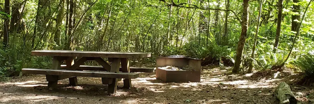
Horseshoe Bend Campground is situated in a stand of old growth Douglas fir, sugar pine, and deciduous trees, on the banks of the Wild & Scenic North Umpqua River. The campground offers the perfect setting for families, anglers, whitewater enthusiasts, and anyone who wants to escape and relax in their natural surroundings.
Sites and hookups
- Campsites
- 25
- Max RV length
- 35 ft
- Pull-through sites
- 1
- Waterfront sites
- 14
- Accessible sites
- 5
- Pets
- Allowed
- Campfires
- Allowed
- Booking
- Reservable on Recreation.gov
Amenities
- Flush toilets
- Drinking water
- Camp host
RV parks near Horseshoe Bend Campground
Nearest first, within 25 miles. Hookups are what each park lists.
More federal campgrounds nearby
- Deer Flat Group Site (Horseshoe Bend Campground)0 mi · Forest Service1 site · RVs to 35 ft
- Eagle Rock Campground3.7 mi · Forest Service27 sites · RVs to 30 ft · 3 pull-through · Waterfront sites
- Boulder Flat Campground5.2 mi · Forest Service9 sites · RVs to 24 ft · Waterfront sites
- Steamboat Ball Field Group Site6.2 mi · Forest Service1 site
- Canton Creek Campground6.6 mi · Forest Service5 sites · RVs to 24 ft · Waterfront sites
- Bogus Creek Campground9.1 mi · Forest Service14 sites · RVs to 30 ft · 1 pull-through
- Scaredman Recreation Site9.2 mi · BLM10 sites · Waterfront sites
- Toketee Group Site11.1 mi · Forest Service1 site · RVs to 35 ft · 1 pull-through
Public recreation nearby
Trailheads, access points and public lands within 25 miles.
- Umpqua National ForestPublic land · 2 mi to center · Forest ServiceDetails
- Susan Creek Falls Trail and Day-Use AreaPublic land · 14 mi to center · BLM
- Wolf Creek Recreation AreaPublic land · 16.7 mi to center · BLMDetails
- North Umpqua Wild and Scenic RiverPublic land · 18.3 mi to center · BLMDetails
- Swiftwater Day-Use AreaPublic land · 19.2 mi to center · BLM
- Crater Lake National ParkPublic land · 34.6 mi to center · National Park ServiceDetails
Data Source: Recreation.gov


