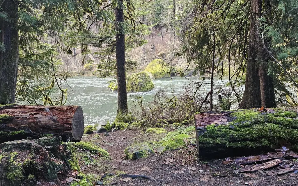
Photo: USFS
Site map
9 campsites at their real positions, from the agency's own site coordinates.
- Campsite
- Loop, in site-number order
Loading map…
About this campground
Situated along the upper reaches of the Wild and Scenic North Umpqua River, Boulder Flat Campground is an enchanting site, lush with greenery from end to end. Popular with whitewater enthusiasts, this campground offers a raft put-in that is the start of many memorable raft trips.
Sites and hookups
- Campsites
- 9
- Max RV length
- 24 ft
- Waterfront sites
- 8
- Accessible sites
- 5
- Pets
- Allowed
- Campfires
- Allowed
- Booking
- Reservable on Recreation.gov
Amenities
- Vault toilets
RV parks near Boulder Flat Campground
Nearest first, within 25 miles. Hookups are what each park lists.
More federal campgrounds nearby
- Eagle Rock Campground1.6 mi · Forest Service27 sites · RVs to 30 ft · 3 pull-through · Waterfront sites
- Deer Flat Group Site (Horseshoe Bend Campground)5.2 mi · Forest Service1 site · RVs to 35 ft
- Horseshoe Bend Campground5.2 mi · Forest Service25 sites · RVs to 35 ft · 1 pull-through · Waterfront sites
- Toketee Group Site6.3 mi · Forest Service1 site · RVs to 35 ft · 1 pull-through
- Toketee Lake Campground6.3 mi · Forest Service32 sites · RVs to 24 ft · 8 pull-through
- Steamboat Ball Field Group Site10.5 mi · Forest Service1 site
- Canton Creek Campground10.7 mi · Forest Service5 sites · RVs to 24 ft · Waterfront sites
- Scaredman Recreation Site12.9 mi · BLM10 sites · Waterfront sites
Public recreation nearby
Trailheads, access points and public lands within 25 miles.
- Umpqua National ForestPublic land · 4 mi to center · Forest ServiceDetails
- Susan Creek Falls Trail and Day-Use AreaPublic land · 19.1 mi to center · BLM
- Wolf Creek Recreation AreaPublic land · 21.9 mi to center · BLMDetails
- North Umpqua Wild and Scenic RiverPublic land · 23.3 mi to center · BLMDetails
- Swiftwater Day-Use AreaPublic land · 24.2 mi to center · BLM
Data Source: Recreation.gov


